tygerprints ,

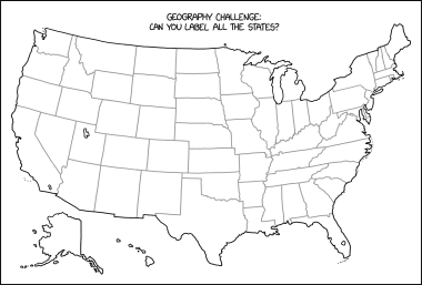
Unless you're including all the minor islands and territories, the U.S. only has 50 states to speak of. I know I could identify my state, Texas, Hawaii, California and a couple others. If there are people who can name up to 50 states and where they are on a map, that's pretty damn impressive!

InquisitiveApathy ,

Look a little closer at the map.

I’m pretty sure you’ll be able to do it. I have faith.

tygerprints ,

I did finally. My bad for not spotting the anomalies right off. See, your wonderful christian attitude was so helpful.

JackGreenEarth ,
@JackGreenEarth@lemm.ee avatar

Why are you giving Christianity a monopoly on faith?

tygerprints ,

I think in this country, Christianity does have a monopoly on faith. And monopoly is a good word to use, because religion is really just big business and those who make the most money hold all the cards.

NeoNachtwaechter ,

Calm down. Yes, of course there are a few people who can, but fortunately most of them live in that small part of the world that is still outside the US.

tygerprints ,

That's true. I doubt most U.S. citizens could actually name most of the states or their locations on a map of the U.S. All I'm saying is that if they can, that's pretty impressive - because so many young people today can't even name a country at random.

Trainguyrom ,

A couple of my friends had a go at this one:

https://reddthat.com/pictrs/image/8bc6537e-f453-40bd-92ef-794e1572c139.png

Some notable quotes:

“Wrong. It goes washingyon, oregon, gravity falls, hotel california”

“pennywise AND ohio, rough spot for maine”

“New Hampsire is not a state. I haven’t heard shit from someone in New Hampshire”

Infynis ,
@Infynis@midwest.social avatar

I don’t know if that’s West Ohio or East Indiana, but either way, it is a crime against nature

HopingForBetter ,

We're always as war with East Asia Indiana.

robotopera ,

An Ohio without Columbus is an Ohio I want to be a part of.

randoot OP ,

I was expecting this one to be interactive but then I noticed the alt text. I’m not a geography nerd who’s going to explain this one

dragontamer ,

Working from the bottom left… California, Arizona, New Mexico… Wtf?

cerement ,
@cerement@slrpnk.net avatar

California, Arizona, New Mexico, Old Mexico, Texas …

brown567 ,

The map looks correct at first glance, but he’s added another 14 states by drawing the borders wrong XD

pomodoro_longbreak ,
@pomodoro_longbreak@sh.itjust.works avatar

Not American, but I assume it’s wrong in some subtle and hilarious way?

beckerist ,

[Thread, post or comment was deleted by the author]

  • Loading...
  • Ageroth ,

    I just moved out of Kentucky and was like wait, there’s two Tennessee?

    SpaceNoodle ,

    Tennessee and Elevennessee

    cerement ,
    @cerement@slrpnk.net avatar

    spoilerexplain xkcd

    567PrimeMover , (edited )
    @567PrimeMover@kbin.social avatar

    Yeah, he's got Minnesota in there but totally left out Megasota

    Two Tennessees, but no nineessee

    Texoklahoma is up by Midsouthdakota?

    North-West Virginia isn't even a thing no matter what those weirdos say

    The weird strip of land in the Great Lake

    Removed Whodaho and added "Idaho"? WTF is Idaho?

    It's got the state we all agreed doesn't exist?

    kool_newt ,

    Glad Orejon is included though.

    NeoNachtwaechter ,

    And where is Mickeysota?

    ricecake ,

    Bunch of extra states with similar shapes to existing states, so it messes with your eye and kinda blends in.

    Might be harder to do with a map of Africa, Asia, Europe or south America because there aren’t as many straight line borders and things are a bit more curvy.

    tygerprints ,

    I see what you mean about this map being anomalous. Some of the states seem to be doubled, I wondered where they got that 64 states figure from!! My bad!

    Doomsider ,

    My favorite is asking people what the 51st state is, Hawaii or Alaska?

    criticon ,

    How many states are in New Mexico?

    merc ,

    What’s interesting are the states you can’t modify too much or it gives away the game.

    Texas is a key example, people are pretty familiar with that shape, even many non-Americans will recognize it. Florida and California are also pretty well known. Also, many people have a rough idea of NY State, though you could probably tweak the north and west borders a bit and nobody would notice too much.

    The ones it’s easy to fiddle with are the rectangular ones in the mid-west. I think a lot of people only know them starting from another reference point, like “north of Texas” or “east of Nevada”.

    JollyG ,

    Tennessee and Elevenessee

    SgtAStrawberry ,

    Ninessee pronounced Nanci

    callyral ,
    @callyral@pawb.social avatar

    Texas, California, Colorado, Wyoming, Colorado again-… wait a minute

    Perhapsjustsniffit ,

    Canadian here, from the outside it seems to just be 3 states. Almost crazy, crazy and don’t come here if you want to exist.

    Bojimbo ,

    Most forget to put both New and Old Hampshire

    Whelks_chance ,

    Old Hampshire is surprisingly close to the original Zealand.

    ornery_chemist ,

    I’m just tickled that this map shows MN’s northwest angle as the (pseudo)exclave that it is.

    MyTurtleSwimsUpsideDown ,

    I’ve got: Neo Hampshire, Middle Carolina, Outdianna, Tennetucky, Rkansas, Northwest Dakota, West South Dakota, Souther Dakota, The Real South Dakota, Coloradon’t, Becausoming, Ariz Oh No!, Udaho & Trail

    TheGreenGolem ,
    fujiwood ,

    The United States of America

    rhythmisaprancer ,
    @rhythmisaprancer@kbin.social avatar

    United Stateses

    EchoCranium ,

    North and South Dakota now have a Middle Dakota buffer zone.

  • All
  • Subscribed
  • Moderated
  • Favorites
  • random
  • [email protected]
  • All magazines